


PHOENIX – The remnants of what was once Hurricane Priscilla in the Eastern Pacific, in combination with other ingredients, are making for a wet, and potentially dangerous, weekend across portions of the Southwest, with some communities seeing more than 2 inches of rain by the time the event is over.
Moisture from the former Category 2 hurricane began to stream into the area on Tuesday, and some severe weather was reported on Wednesday.
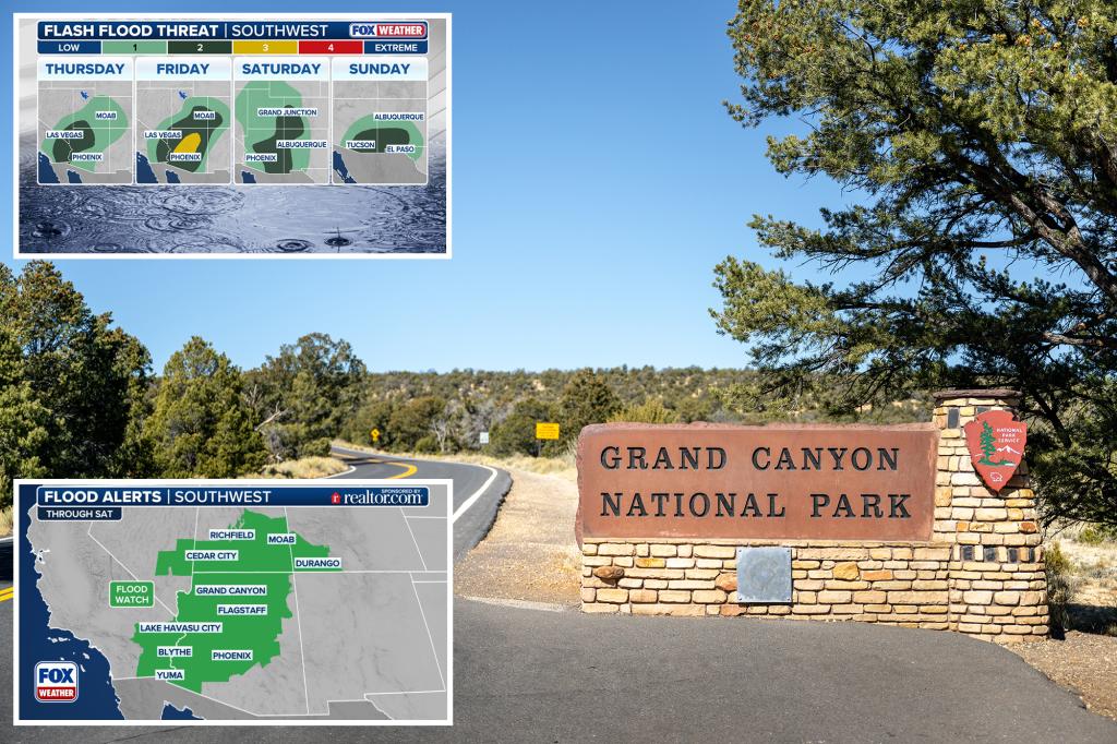
Computer forecast models show coverage and intensity of the precipitation is expected to increase as we approach and enter into the upcoming weekend, which is leading to fears of flash flooding through at least the start of next week.
The foothill and mountain areas north and east of Phoenix appear to be in the greatest threat zone, with the terrain helping to intensify the rainfall rates.
Because of the threat, NOAA’s Weather Prediction Center (WPC) placed areas of Southern California, northwestern Arizona and southwestern Utah in a Level 2 out of 4 flash flood threat.
That threat grows on Friday, however, and most of central Arizona, including the Phoenix area, has been placed in a Level 3 out of 4 flash flood threat.
Flood Watches are in effect across a large swath of the Southwest and include cities like Phoenix and Flagstaff in Arizona, as well as Grand Canyon National Park.
“Excessive rainfall may result in flooding of slot canyons, normally dry washes, slickrock areas, recent burn scars and other low-lying and flood-prone locations,” National Weather Service staff warned.
The rainfall is not associated with the annual monsoon, which officially ended last month, and is instead being driven by tropical moisture from the Pacific and energy from a dip in the jet stream farther north.
According to forecasters, just 6 inches of fast-moving water can knock an adult off their feet, and a foot of floodwater can carry a car away.
In addition to the dangers, the prolonged wet weather event will have two primary benefits: drought relief and cooler temperatures.
More than 80% of the western U.S. is facing unusually dry conditions, with some communities officially in “exceptional drought” status – the most intense level of drought.
At this stage, communities typically face widespread crop losses, water shortages and significant wildfire risks.
With all the rainfall, the fire risk level is expected to drop along with temperatures.
Highs that climbed into the 90s earlier in the week will be held in the 80s as increased cloud cover and widespread rain move in.
Additional precipitation from Invest 90E, which will likely become Raymond over the next five days along the Mexican coastline, is also expected to stream into the Southwest, but not before the end of the weekend.
Read the full article here


